
In Nahuatl, it’s called Citlaltépetl, the Star Mountain, a shimmering snow-covered peak that dominates the horizon for hundreds of kilometers. At 5,640 meters (18,504 feet) El Pico de Orizaba is Mexico’s tallest mountain and the third highest in North America.
Those who live on its flanks say the only way you can fully appreciate the beauty of Orizaba is to circumnavigate the volcano on foot, and after much effort, a few of them have established the sort of route that trekkers love: difficult, challenging, but extraordinarily rewarding.
One of the pioneers who developed the Orizaba loop is Victor Vivero, who goes by the trail name Amadeus. For the last four years, Amadeus and friends have worked on connecting several already established tracks to create what they call La Circumvalación, The Loop.
I asked Amadeus to describe his most recent trek along The Pico de Orizaba loop.


“This took place in July,” he told me. “Our group met at a place appropriately called El Valle del Encuentro (the Meeting-place Valley), located in Pico de Orizaba National Park on the South Face of the volcano. Here there’s a mountain refuge, located in a big valley close to a small hill from which you have great views of both el Pico de Orizaba and the Sierra Negra Volcano, where the Large Millimeter Telescope (the biggest of its kind in the world) is located.
Beginning the Pico de Orizaba loop at 1:00 a.m.
The trekkers fell asleep in the shelter at 9:00 p.m.
“Our plan,” said Amadeus, “was to get up at 1:00 a.m. and start hiking. We needed to start very early so we’d be sure to reach the next refuge before dark. This way we wouldn’t need to carry tents. However, it was raining hard. So we waited another hour and started walking at about 2:30.There had been a race in this area recently so there was reflecting tape on the trees, making it easy to follow the trail in the dark. but you can always use Wikiloc to follow a route at night.
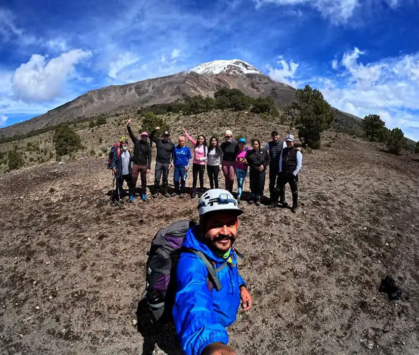
“For the first seven km the land was flat and here is where we got our rhythm. There were 12 of us, which is a rather big group, but we were soon nicely synchronized.
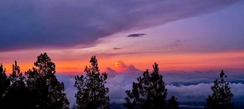
A sea of clouds
“Near sunrise, we reached the edge of a canyon. Below us stretched a whole sea of clouds. What a view! We had to bottom this canyon, but as we reached the top of the opposite end, we could enjoy a spectacular sunrise, right in front of us.”
“Now, after six hours, surrounded by pine trees, we were reaching the East Face, where we came to another canyon which everybody calls La Rompe Piernas, The Leg Breaker, because crossing it is very tricky. It has some very steep slopes and negotiating the whole thing is very tiring.”
Dwarf snakes and tiny rabbits
“Here we could hear birds, especially eagles and here you can also find rattlesnakes. These are what we call cascabeles enanas, “ dwarf rattlesnakes.” They are only 50 to 80 cm long, and they are poisonous. In this same area, I’ve also seen tiny teporingos or volcano rabbits. They’re endemic to Mexico and so small they weigh only half a kilo (one pound).”

Two hours beyond The Leg Breaker, the trekkers came to the Ice Cascades, where water pours out of two caves and freezes in the winter.
“Now we were on the Northeast Slope of the volcano,” Amadeus told me, “and here we filled our canteens with this water, which is good to drink. At this point, we had covered about half the first day’s march.”
“Next, to get to the North Face, you have to cross another canyon called La Barranca del Río Jamapa, named after the river created by the runoff from the volcano’s Jamapa Glacier. On the other side, we had to traverse a sandy space called Arenal, and then at about 6:30—after covering 27 kilometers in 17 hours—we reached our second mountain refuge, called Piedra Grande, Big Rock. No sooner did we get there than the weather turned bad. Suddenly it was cold, wet, and windy, but around 9:00 p.m. it all cleared up.”
Piedra Grande mountain shelter
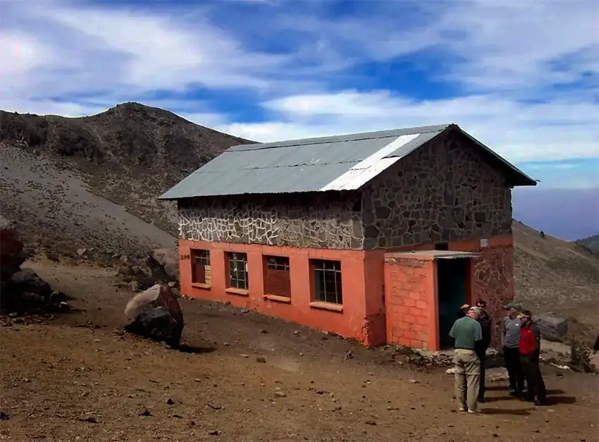
The Piedra Grande refuge is on Pico de Orizaba’s North Face and is used by many climbers heading for the peak. Amadeus and friends had started out very early in the morning to make sure they would get bunks in this shelter, which holds 40 people when full.
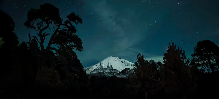
“We arrived at the refuge really beat,” continued Amadeus. “[We] broke out our little cook stoves and made things like soup and coffee. Then we slept until 2:30 a.m., ready to go again. The weather was cold, but the sky was so clear, that we saw several shooting stars. After a while, we reached what we call The Wall. It’s almost vertical and takes us to the bottom of a canyon called La Barranca del Alpinaua. Here we always wear helmets and we break up into groups of three.
Treacherous riverbed
“At the bottom we came to the most dangerous part of the whole trek, a riverbed with plenty of loose rocks, some of them very big. So here too, we negotiate the area in small groups. This barranca is only 500 meters wide but it took us maybe two hours to cross it.”
The hikers now arrived at the West Face, a long area of grassy meadows over 3,800 meters high, with hardly any trees. “On this high plateau,” commented Amadeus, “I think we enjoyed the very best views of Pico de Orizaba and from here we could also see Popocatepetl, El Iztaccíhuatl, and La Malinche.”
From this point the party had only nine kilometers more to go, up and over their last obstacle, the Saddle of Cerro Colorado, a pass 4,330 meters above sea level and the highest point of the entire loop.
“From this saddle,” Amadeus told me, “it’s all downhill, and about 1:00 p.m. we arrived back at our starting point on the South Face, so we spent about 10 hours on our second day, but the distance we covered was only 13 kilometers.
“In those two days we walked 40 kilometers and got to see all the faces of North America’s third-highest peak, views that very few have ever observed or photographed. It’s an incredible route!”
John Pint has lived near Guadalajara, Jalisco, for more than 30 years and is the author of A Guide to West Mexico’s Guachimontones and Surrounding Area and co-author of Outdoors in Western Mexico. More of his writing can be found on his website.
Source: Mexico News Daily


