Google Maps clue helps solve crime in Spanish village
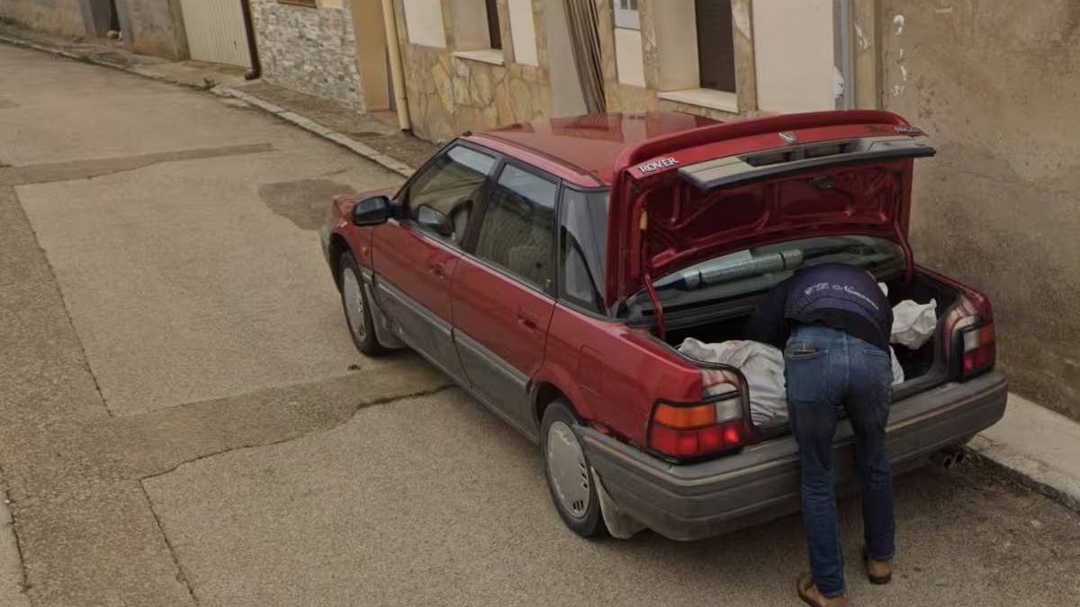
A photograph on the online map service provided an unexpected clue that helped law enforcement in their nvestigation into the disappearance of a man a year ago in Soria, leading to the recent arrest of two people.
Spanish authorities have cracked a year-long murder mystery with an unexpected assist from Google Street View.
The National Police recently arrested two individuals in the Spanish province of Soria for their alleged involvement in the disappearance of a man of Cuban origin in late 2023.
In their investigation, officers were checking for clues on online services when they noticed a Google Maps image that appeared to show a person loading what might be human remains into the trunk of a car.
The photograph was taken by a Google Maps vehicle in the Soria municipality of Tajueco, a small village with only a few dozen inhabitants.
The two suspects, arrested last Thursday, were a woman identified as the victim’s partner and her ex.
The man’s disappearance was reported on 23 November last year by a relative who had received suspicious messages purportedly sent by the missing man, which raised concerns.
Authorities have since uncovered part of what is believed to be the victim’s remains, pending definitive identification, buried in a cemetery in the municipality of Andaluz, also in the province of Soria.
According to the National Police, the remains were located using advanced forensic technology.
The investigation remains ongoing to clarify the events, but police have gathered sufficient evidence to identify those allegedly responsible for the man’s disappearance and death.
Source: Euro News


