‘Hidden threats’: Indonesia’s Bandung earthquake triggered by unmapped fault, say experts
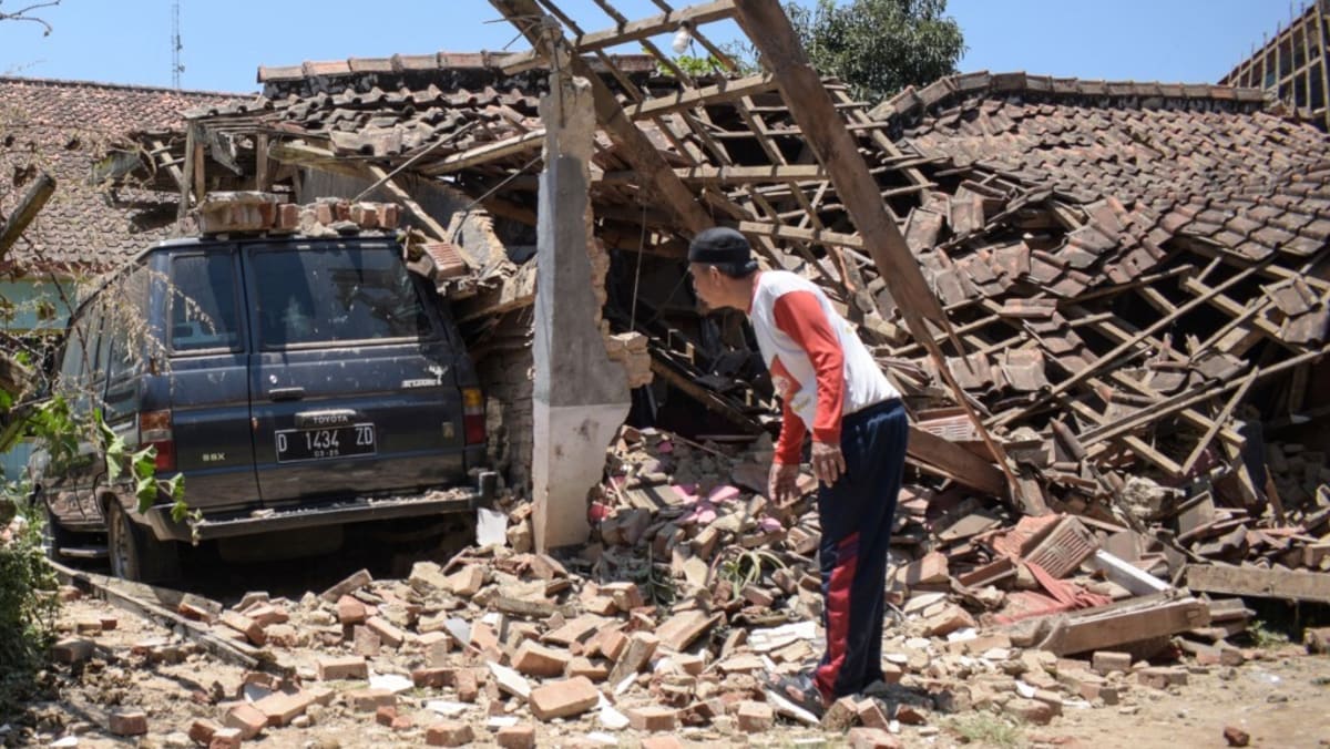
JAKARTA: West Java’s sudden earthquake on Wednesday (Sep 18) which left one dead and over 80 injured was triggered by an unmapped fault, according to Indonesian earthquake experts.
Head of Indonesia’s National Agency for Disaster Management (BNPB)’s Center for Disaster Data, Information and Communication Abdul Muhari on Thursday said researchers initially predicted the quake occurred on two active faults in West Java.
But when mapping was done, it turned out it had occurred on a previously unmapped fault.
“There are two segments of the Garsela Fault, the distribution of the first earthquake and aftershocks is not on the active Garsela fault, nor is the Lembang Fault,” said Mr Abdul as quoted by Antara news agency.
The West Java Regional Disaster Management Agency (BPBD) reported that the magnitude-5 earthquake in Bandung damaged hundreds of houses with a loss of 385 billion rupiah (US$25 million) and displaced more than 700 people.
The epicentre was on land 25km southeast of Bandung regency with a depth of 10km.
Indonesia is one of the most earthquake-prone countries in the world as it is located at the meeting point of three tectonic plates, known as the Ring of Fire.
Scientists have said that a large earthquake, possibly followed by a tsunami, is inevitable in Indonesia, due to movement on the megathrust, the zone where two large plates meet.
“The release of earthquakes in these two segments can be said to be ‘just a matter of time’ because it has been hundreds of years since a major earthquake occurred,” Mr Daryono, head of the BMKG’s Earthquake and Tsunami Centre, said in his post on X in August, about the two megathrusts in Sumatra and Java.
Like many Indonesians, Mr Daryano goes by one name.
Efforts to map active faults are still ongoing in Indonesia to plan appropriate disaster mitigation strategies.
Active faults are faults that have moved or caused earthquakes in the last 10,000 years.
Researcher from the National Research and Innovation Agency (BRIN) Nuraini Rahmah Hanifa in April said that in the 2017 Indonesian earthquake mapping, there were 295 active faults throughout Indonesia, 31 of which were in Java, the country’s most populous island.
With better technology, scientists in 2024 found additional active faults that were previously unmapped. Currently, there are more than 400 active faults in Indonesia, 75 of which are on Java Island.
“Of these, less than 30 per cent have well-known parameters,” Ms Nuraini was quoted as saying on BRIN’s website in April.
In Indonesia, there have been several unexpected earthquakes triggered by unmapped faults. One of the biggest was the earthquake in Cianjur, West Java, in 2022, which killed around 600 people and damaged 58,000 houses.
BNPB’s Mr Abdul said that the Bandung earthquake has become a serious concern for the agency to study active fault points that have not been mapped to minimise the number of casualties.
Ms Nuraini explained that with accurate fault-mapping and appropriate disaster mitigation strategies, the government can narrow down disaster-prone areas and use the mapping data as a basis for disaster mitigation policies.
However, she admits that mapping active faults is not an easy task, especially in places such as Java which is already heavily populated.
“Geological research requires digging the ground. If there are many houses, it makes it more difficult to do the research,” said Ms Nuraini.
Source: CNA


