Hilary track and updates: 1st ever tropical storm watch issued for California
Southern California and the Southwest are bracing for flash flooding.
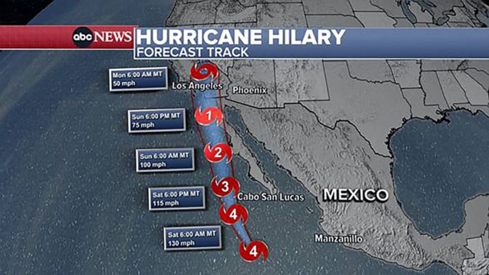
Hilary, now a powerful Category 4 hurricane, is expected to make landfall in Mexico’s Baja California on Sunday and then weaken to a tropical storm before crossing into California Sunday night.
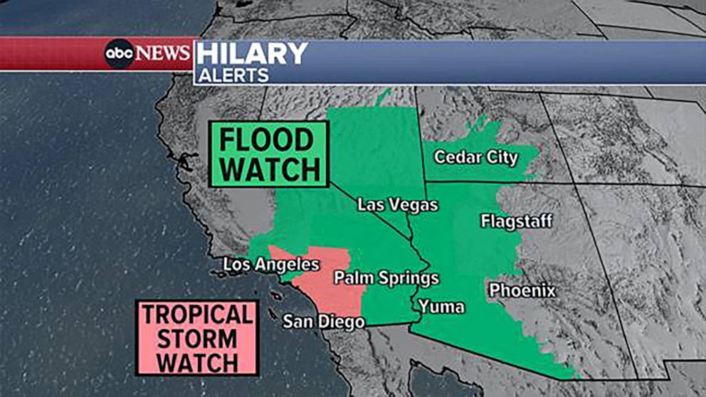
The first tropical storm watch in California’s history has now been issued. The watch is in effect for portions of Southern California including San Diego, Palm Springs, Riverside and the mountains of Los Angeles County.
Hurricane Hilary remains a category 4 hurricane with maximum sustained winds of 145 mph. The center of Hilary is located roughly 360 miles SSW of Cabo San Lucas, Mexico, and it is moving to the NW at 10 mph.
ABC News
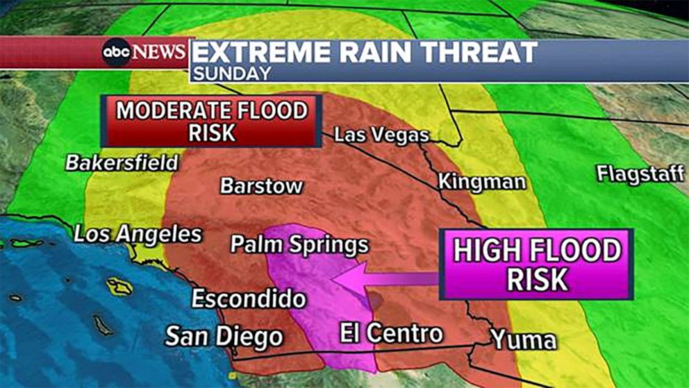
Southern California is bracing for heavy rain, potentially historic flash flooding, mudslides and gusty winds on Sunday through Monday morning.
The worst of the rain will hit Southern California on Sunday from Palm Springs to the Mexican border. Some desert areas could see more than one year’s worth of rain in just one or two days.
Hurricane Hilary remains a category 4 hurricane with maximum sustained winds of 145 mph. The center of Hilary is located roughly 360 miles SSW of Cabo San Lucas, Mexico, and it is moving to the NW at 10 mph.
ABC News
The greater Southwest area, including Las Vegas, could also see flash flooding from this very rare event.
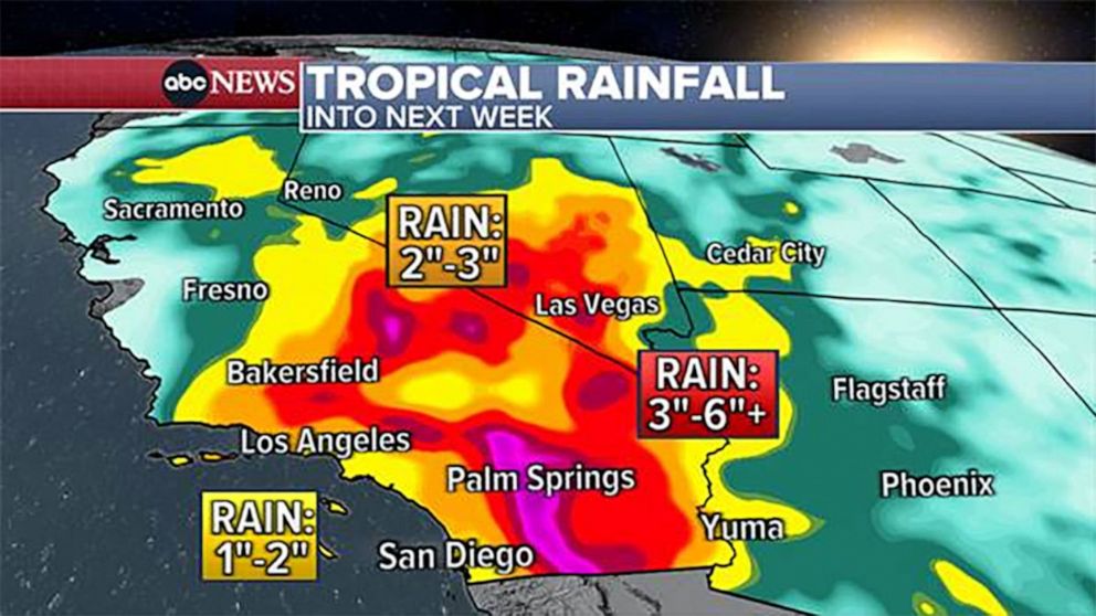
Most areas will see 2 to 6 inches of rain, but some areas could see up to 10 inches of rain.
Hurricane Hilary remains a category 4 hurricane with maximum sustained winds of 145 mph. The center of Hilary is located roughly 360 miles SSW of Cabo San Lucas, Mexico, and it is moving to the NW at 10 mph.
ABC News
Hurricane Hilary remains a category 4 hurricane with maximum sustained winds of 145 mph. The center of Hilary is located roughly 360 miles SSW of Cabo San Lucas, Mexico, and it is moving to the NW at 10 mph.
ABC News
Southern California beachgoers should also be mindful of high surf.
In Mexico, a hurricane watch was issued in Baja California where rough seas, scattered showers and thunderstorms are in the forecast for Saturday.
A hurricane prevention zone has been established from north of Punta Abreojos to Punta Eugenia in Baja California Sur, the Mexican secretary of the environment said Friday. Ships are urged to take “extreme precaution” due to the strong winds and high waves forecast for the area.
A tropical storm warning is in effect for Cabo San Lucas. Hilary’s outer bands could graze the popular resort town but it is not forecast to directly hit Cabo.
ABC News’ Anne Laurent and Ellie Kaufman contributed to this report.
Source: abc news


