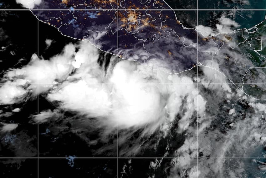
Hurricane John strengthens as it nears Oaxaca coast

Hurricane John, currently located 160 km southwest of Puerto Escondido, Oaxaca, is forecast to rapidly strengthen into a major hurricane, bringing extraordinary rain to the coast of Oaxaca on Monday night through Tuesday morning.
The United States’ National Hurricane Center (NHC) expects John to produce 25 to 50 cm of rain along the Oaxaca coast and southeast Guerrero, with maximum sustained winds of 140 km/h. The NHC urged that “preparations to protect life and property should be rushed to completion,” as the storm is forecast to make landfall near Puerto Escondido in the next 24 hours.
Tropical Storm #John has strengthened into a Hurricane 🌀⚠️
Continued intensification is expected until landfall over the Mexican state of Oaxaca late Tuesday, possibly as a Major Hurricane. pic.twitter.com/oVE3PZGBje
— Zoom Earth (@zoom_earth) September 23, 2024
A hurricane warning is in effect for the area between Punta Maldonado, Guerrero, to Bahías de Huatulco, Oaxaca. A tropical storm warning is in effect east of Bahías de Huatulco to Salina Cruz, as well as west of Punta Maldonado extending to Acapulco.
Oaxaca civil protection authorities have advised at-risk municipalities to install temporary shelters for residents. Civilians are encouraged to stay alert to official information here.
The rain and wind forecast by state in Mexico’s southwest is as follows:
Oaxaca: Extraordinary rainfall (+250 mm) with wind gusts of 100 to 120 km/h and waves of three to five meters high in coastal areas.
Chiapas and Guerrero: Torrential rainfall (150 to 250 mm) with gusts of 40 to 60 km/h and waves of one to three meters high, with waterspouts possible.
12:00 PM CST Key Messages on #Hurricane #John: John rapidly strengthens to a hurricane. John is forecast to rapidly intensify into a major hurricane before making landfall in southern #Mexico. Preparations to protect life and property should be rushed to completion. pic.twitter.com/ETpaepxLbo
— NHC Eastern Pacific (@NHC_Pacific) September 23, 2024
The NHC has said that Hurricane John will cause “large and destructive waves,” as well as potentially “catastrophic, life-threatening flash flooding and mudslides” to the coasts of Chiapas, Oaxaca and southeast Guerrero.
The national weather agency has cautioned residents of these areas that strong winds may lead to falling trees and billboards.
Monday weather forecast for the rest of Mexico:
Intense rainfall: Campeche, Quintana Roo, Tabasco and Yucatán.
Very heavy rainfall: Chihuahua, Durango, Michoacan, Morelos and Puebla.
Heavy rainfall: Mexico City, Colima, México state, Jalisco, Nayarit, Nuevo Leon, San Luis Potosi, Sinaloa, Tamaulipas and Tlaxcala.
Showers: Aguascalientes, Coahuila, Guanajuato, Hidalgo, Querétaro and Zacatecas.
High winds from Hurricane John may reach some areas of México state through the end of the week.
Mexico News Daily
Source: Mexico News Daily

