
The week after Hurricane John made landfall (once as a hurricane, once as a tropical storm) in the state of Guerrero, devastating Acapulco and inundating coastal areas from Oaxaca to Michoacán, Tropical Depression Eleven-E is expected to become a tropical storm on Thursday when it makes landfall on the coast of Oaxaca.
In an advisory posted at 9 a.m. CST on Thursday, the U.S. National Hurricane Center (NHC) warned that “the depression is forecast to become a tropical storm and is likely to bring heavy rainfall to portions of southern Mexico this week.”
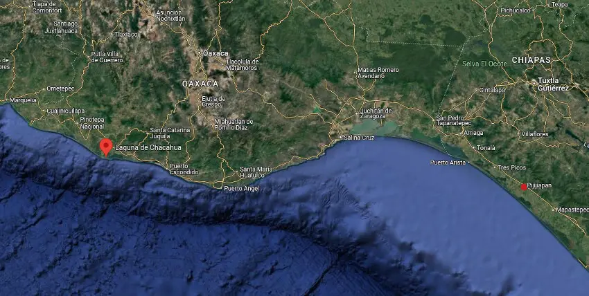
As of 9 a.m. Central Mexico time, Mexico’s national weather agency (SMN) reported that the depression was located 85 km to the southeast of Bahías de Huatulco and would make landfall as a tropical storm on Thursday night, between Bahías de Huatulco and Salina Cruz, Oaxaca. The SMN has issued a tropical storm warning for the area stretching from Lagunas de Chacahua, Oaxaca (north of Puerto Escondido) to Pijijiapan, Chiapas.
On Thursday morning, the SMN forecast torrential rains (150-250 millimeters) for Guerrero and Oaxaca as the depression interacts with a low-pressure system and a monsoon trough over the southeastern Gulf of Mexico. Humid air from the Pacific and the Gulf will also feed the system moisture, producing electrical storms and hail, according to weather news site Meteored.


The SMN projects the storm will make landfall with winds of 60-80 km/h, producing 1- to 3-meter waves along the Oaxaca coast.
The NHC warns of “flooding and mudslides, especially in areas of steep terrain in Chiapas, Oaxaca, Veracruz, Tabasco and coastal Guerrero.”

The storm system is also expected to dump very heavy rains (75 to 150 mm) on Chiapas, Tabasco and Campeche, while also sending considerable rainfall to Puebla (50 to 75 mm).
The forecast is bad news for areas already hard-hit by John, which transformed from Tropical Depression Ten-E into a Category 3 hurricane in two days before slamming into the mainland near Punta Maldonado, Guerrero.
In her first full day on the job Wednesday, President Claudia Sheinbaum visited the coastal Guerrero resort city of Acapulco in the company of Governor Evelyn Salgado to survey the damage.
The president ordered the National Water Commission (Conagua) to expedite the restoration of potable water service while the federal highway department works to clean up and repair roads and bridges to facilitate rescue efforts.
Elsewhere, a mass of cold air will sweep down from northern Mexico, causing low temperatures in high elevations in northern states and cool temperatures in the Mesa Central.
Mountainous regions in Chihuahua, Durango and México state can expect to see freezing temperatures (–5 to 0 C), while higher elevations in Coahuila, Nuevo León, San Luis Potosí, Zacatecas, Aguascalientes, Jalisco, Michoacán, Guanajuato, Querétaro, Hidalgo, Veracruz, Puebla, Tlaxcala and Mexico City could dip down to 0 C Thursday night.
With reports from El Economista and Meteored
Source: Mexico News Daily


